www.positionintegrity.com
PACMAN relies
on GeoTIFF standards to
promote interoperability
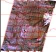
300-Meter Imagery for
Situational Awareness
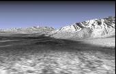
30-Meter Imagery
Draped over
30-Meter SRTM Terrain
Visit
www.geotiff.net
for a on-line demonstration of NASA imagery